Jarvis Island (English version: Jarvis Island) is a small island in the Line Islands Archipelago, located in the central Pacific Ocean about 2,200 kilometers south of Hawaii.
The island takes its name from its discoverer, British captain James Brown, after the brothers Edward, Thomas, and William Jarvis, who were Brown’s ship owners and employers. Bunker Island has been referred to in English as Bunker Island, in honor of the American captain who was long credited with the discovery of the island. Recently, however, this name has been used less and less frequently both in descriptions of the island and in its mapping.
The total area of Jarvis Island is just under four and a half square kilometers.
Jarvis Island is currently a dependent unincorporated unorganized U.S. territory administered by the U.S. Department of the Interior under the Congressionally mandated National Wildlife Refuge Program. The government of the Republic of Kiribati is currently contesting the territorial ownership of Jarvis Island, as well as other US possessions within the Line Archipelago (Johnston and Palmyra atolls and Kingman Reef), and is demanding its transfer to its jurisdiction.
History
Jarvis Island, uninhabited at the time, was discovered to Europeans on 21 August 1821 by the British ship Eliza Frances under the command of Captain James Brown, who named the island after his shipowners and tenants.
In 1824, Jarvis Island was visited by the American whaling ship Hortensia, commanded by Captain Barrett Banker, who mistakenly believed that he was the discoverer of the island. Naturally, in this case, Banker named the island after himself.
On February 27, 1858, the United States annexed Jarvis Island under the Guano Act and proceeded to colonize it.
In the middle of that year, the American Guano Company, which specialized in guano mining, begins developing Jarvis and Baker Islands by building a narrow-gauge railroad to transport the mined material and two-story dwellings for the quarry workers.
In 1879 guano mining on the island suddenly ceases, and the workers’ settlement falls into disrepair.
In the early 1980s, New Zealand tried to revive the guano industry by bringing workers to the island and rebuilding housing on the island. However, falling demand and prices for guano lead again to the desolation of the island, and the last inhabitant in the workers’ camp, left as a watchman, commits suicide here in 1883.
The British John T. Arundel & Co. resumed guano mining on Jarvis in 1886, which was the basis for Britain’s annexation of the island on June 3, 1889. Owner and manager John Tower Arundel personally visited the island in 1909, ordering the construction of additional buildings for workers and a lighthouse, which was later named after him and operated until 1935.
On August 30, 1913, the bunker ship Amaranth, carrying a cargo of coal under Captain Nielsen, en route from Newcastle, New South Wales, Australia, to San Francisco, collided under poor visibility with a coastal reef on the south side of Jarvis Island and broke in two on impact. The surviving crew of the Amaranth reached Apia and Pago Pago on the islands of Samoa by two dinghies.
On March 26, 1935, Jarvis Island is reannexed to the United States and, along with Howland and Baker Islands, begins to be partially colonized by American volunteers as part of a government program. The colonists rebuilt the old workers’ camp during this period, naming it Millersville, reconstructing the lighthouse and building a small dirt airstrip with landmarks visible from the air.
After the outbreak of World War II in the Pacific, a Japanese submarine approached the west coast of Jarvis Island and shelled the Millersville structures and airstrip. The shelling caused considerable damage to the settlement, but no casualties.
On February 7, 1942, the USCGC Taney (WHEC-37) corvette evacuated the colonists from Jarvis, and the island itself was reportedly shelled twice more by Japanese submarines, resulting in the complete destruction of Millersville, the lighthouse and the airstrip.
In the postwar period, the United States abandoned its intentions to repopulate Jarvis, and in 1958 a severe cyclone that struck the island wiped out both the remaining structures of Millersville and other traces of human colonization.
On June 27, 1974, U.S. Secretary of the Interior Rogers Morton created the Jarvis Island National Wildlife Refuge, which was significantly expanded in 2009 to include coastal waters.
In 1990, the feral cat population introduced to Jarvis Island by colonists was completely wiped out as it had been causing significant damage to the island’s nesting seabirds for years.
Origin and geography of the island
According to its origin, Jarvis Island should be classified as a coral island. According to experts, the island began to form during a period of time distant from us by about 2-3 million years ago. During this period, after another underwater volcanic eruption or earthquake, a basalt plate rose to the sea surface, forming a shoal. Corals and seaweed later formed the island’s future base, and sea currents brought mud and sand.
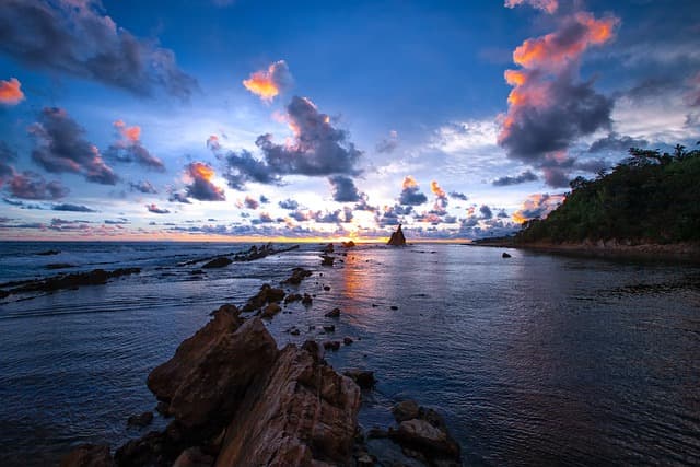
Jarvis Island is trapezoidal in shape, about 1.8 kilometers long and 1 kilometer wide. Unlike the atolls, Jarvis has no inner lagoon. Many experts consider the island’s dried-up inner lagoon its central part in the area of an abandoned guano quarry. Like other coral islands and atolls, Jarvis is surrounded by a powerful coral reef, which is uninterrupted along its entire length and creates a serious obstacle to the mooring of ships to the island, even with a small draft. The shoreline and coastal beaches of the island consist of dark and white coral sand, coral and coral rubble. The relief of Jarvis is lowland and flat. Its highest point is the coastal dune on the west coast, up to 7 meters above sea level. There are no natural sources of fresh water on Jarvis.
Climate
Jarvis Island has a tropical, desert climate, with high daytime temperatures reaching 30 degrees and above. Despite the proximity of the equator, the nights here can be quite cool, sometimes the temperature at night can drop to 7-8 degrees Celsius. A strong, gusty wind constantly blows on the island. Precipitation that falls on the island in the form of short-term rainfall is quite rare, and their number does not exceed 250 millimeters per year. Tropical storms, which are particularly powerful and destructive at these latitudes, are also frequent.
Population
At the moment, Jarvis Island is officially uninhabited, all the buildings made by the people who once lived here, either partially or completely destroyed.
Flora and fauna
The flora of Jarvis Island, due to its sparse soil and corresponding climatic conditions, is mostly herbaceous and shrubby plants. Closer to the central parched lagoon there are rare shrubs.
The animal life of Jarvis is represented only by birds. Cats, introduced by man, feral, and damaging to nesting birds, were exterminated back in 1990. Rats, which were also imported by colonists, did not take root on the island.
A large number of waders nest on the island, three species of which make up the bulk of the bird population.
Coral reefs and coastal waters abound with many species of tropical fish and crustaceans, there are several species of green sea turtles. In search of food, sharks, bottlenose dolphins and royal mantas sometimes come close to shore. Blue corals, which make up most of Jarvis Island’s coral reef.
Tourism
Jarvis Island is currently closed by U.S. government agencies for general tourist visits. You can visit the island only by getting a special permit from the U.S. Department of the Interior, which are issued only to scientists and researchers, and responsible representatives of the U.S. Department of the Interior, Coast Guard and environmental organizations.